Showing posts with label Pandyas. Show all posts

Saturday, April 1, 2017

Padavedu - Land of Thousand Temples: History of Sambuvaraya and Their Capital


Padavedu_GHO71E_20_1500865g.jpg (630×385)
Vijayanagar style Venugopala and Rukmani statues amidst fields PC The Hindu
3157884689_88428f94ee_b.jpg (1024×768)
Renugambal Temple PC Flickr Raju
3148917527_f19abb3497_b.jpg (1024×473)
Entry to Padavedu from Santhavasal PC Flickr Raju
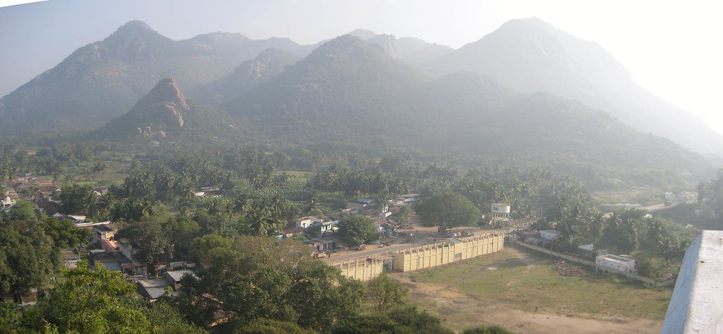
Padavedu (படவேடு) (Padaiveedu (படைவீடு) = Garrison), is a pastoral village located in Polur taluk, Tiruvannamalai district, Tamil Nadu, India Pin Code 632315. The place wherein Renugambal temple located is known as 'A.K.Padavedu' (Amman Koil Padavedu). Padavedu village is 2 km away from A.K. Padavedu and forming part of Padavedu village Panchayat. The nondescript village, surrounded by mist-soaked Javadu hills, sugarcane fields, banana plantations, brick kilns and paddy fields, is 137.3 km away from Chennai, 112 km from Pondicherry and 170.6 km from Bangalore and it is situated in a strategic point among Vellore (30.9 km), Thiruvannamalai (56.7 km) and Arani (20.5 km) in the Vellore – Polur (Thiruvannamalai) route. You will find a junction called Santhavasal (சாந்தவாசல்) at the 32nd km while proceeding from Vellore town. From Santhavasal the village is just 6 km away. Alternate route from Chennai is Arcot - Arani - Santhavasal through the bumpy road. The geographical coordinates of Padavedu are  12° 38' 54.5672" latitude and 79° 7' 58.2449" longitude and the elevation / altitude is 172 m from sea-level.

Sambuvaraya dynasty, who ruled in the 12th and 13th Centuries, had Munnur (முன்னூர்), Virinjipuram (விரிஞ்சிபுரம்) and Kanchipuram (காஞ்சிபுரம்) as their capitals. After becoming independent from Pandyas, Sambuvaraya chose Padaiveedu as their capital for its strategic defensive location i.e., the land bastioned by tall hills and dense forests. The formation of Malayalam forests (மலையாளக்காடு), Shenbaga grove (செண்பகத்தோப்பு) and Athtimalai (அத்திமலை)  on the north-west, Kalimathu hillock (களிமத்துக் குன்று) on the south-west and Santhavasal reserve forests (சாந்தவாசல் காப்புக்காடு) on the south provided adequate defensive measures. Santhavasal was the entry point to the capital. 

The scenic Javadu hill is surrounded by seventeen villages and lush green paddy fields and coconut groves. It is believed that the region was known as the 'land of thousand temples' since it was the home to 1008 Shiva temples and 108 Vishnu temples. Now it is reduced to ten ancient (12th century) temples excluding the most popular Renugambal temple (ரேணுகாம்பாள் கோவில்).

Renugambal Temple (Renuka Paramesvari Temple (ரேணுகா பரமேஸ்வரி கோவில்) also known as Yellamma Temple (எல்லம்மா கோவில்), Padavedu was built by Sambuvaraya. It is one of the most important ‘Sakthi Sthalas’ in Thondainadu. Goddess Renugambal is self-manifested here and a Banalingam is present. Adi Sankarar has consecrated the Nanakarshna Chakra   This south facing ancient temple exists even today. Three inscriptions have been copied from this temple.

Also there is a newly constructed temple. The outer walls of the granite structured vimana is decorated with bas relief images depicting puranic scenes. The goddess resides in the east facing sanctum. There are ardhamandapam, mahamandapam and there are shrines minor deities.

The Sri Venugopalaswami Kainkaryam Trust,(வேணுகோபாலஸ்வாமி கைங்கர்யம் டிரஸ்ட்), a part of TVS group, takes over the village about 20 years back and maintains the age old temples flawlessly. Number of temples were identified, unearthed and renovated by the trust during 1990s. Very few of these temples retain their original facade and the temples include:

DSC01108.JPG (400×267)
PC Tamilnadu Tourism
  1. Lord Venugopala Swamy temple (வேணுகோலஸ்வாமி கோவில்) is located on the top of Rajagambhiramalai (hill top) popularly known as Kottaimalai (Athimalai). The temple opens only on Saturdays from 9 am  to 4 pm. A ghat road runs through the dense forest and leads to the hill top. People used to travel by using the off-road wheeled tractor from the foothill to the hill top over this bumpy route.
  2. Yoga Ramachandraswamy Temple (யோக இராமச்சந்திரஸ்வாமி கோவில்), Padavedu, constructed before 12th Century AD, is located 1 km west of Renugambal Temple. Lord Rama is uncommonly seated in Artha Padmasana posture showing “Chin Mudra” and his hand is not holding his bow (Kothandam). He is accompanied by his consort Seetha and brother Lakshmana by his side. Hanuman appears seated before Rama and engaged in reading Palm leaf manuscripts. Lord Rama is also appear seated and showing 'Chin Mudra' at Nedungunam and Ragunatha Samudram temples, both are located in Tiruvannamalai dist..
  3. Lakshmi Narasimhar Temple (லட்சுமி நரசிம்மர் கோவில்), Ramanathapuram, Padavedu located on a hill top. Kamandala river (கமண்டல நதி) flows by the side of this temple. It was built by Mankonda Sambuvarayar (மண்கொண்ட சம்புவராயர்).  Temple ruined due to natural disaster and now renovated by TVS Group trust. The bridge, built at a later date by the trust, connects the temple and the village. Also there is a cement path leading to the hill top. Goddess Lakshmi is seated on the right side of Narasimhar. 
  4. Velmurugan temple (வேல்முருகன் கோவில்) is located on top of Natchathra Kundru (நட்சத்திரக் குன்று) (Star Hill). A Vel (வேல்) (lance of Lord Muruga) is consecrated by the Bhogar (போகர் சித்தர்), one of the 18  Siddhars and Poojas are performed daily.
  5. Chinna Kottai Varadhar Temple, Padavedu is located 2 km north west of Renugambal temple.
  6. Kailasa Vinayagar Temple (கைலாச விநாயகர் கோவில்), Padavedu is located on the northern side of Renugambal temple with a distance of 2 km. The prime deity Lord Vinayagar is huge and has a height of five and a half feet and looks very majestic. The ancient temple built hundreds of years back was fully destroyed.  The renovation work of this temple was carried out by TVS trust.
  7. Rishi Temple (ரிஷி கோவில்) or (Lord Budha Temple) is located near Renugambal Temple. Rishi idol was retrieved at this spot and consecrated in the newly built temple.
  8. Ammayappa Esvarar Temple, Padavedu, a 12th century temple, is considered as the most ancient temple and located one km west of Renugambal temple. It is the family deity of Sambuvarayas. The prime deity is Ammayappa Esvarar (Lord Shiva) and his consort is five feet tall goddess Aparnambigai. The temple totally buried due to sand storms and excavated. The procession deities hidden underground were also discovered and installed in Utsava Mandapam.
  9. Periya Kottai Varadhar Temple, Padavedu is located 2 km north west of Renugambal temple.
  10. Sadasivan Temple (சதாசிவன் கோவில்) is devoted to Lord Shiva and his consort and located in Vettagiripalayam, Padavedu. 
Also there are few temples built and maintained by the trust:
  1. Kailasanathar Temple (கைலாசநாதர் கோவில்), Kailasaparai (கைலாசப் பாறை), Padavedu is totally in ruin and is located towards north on top of Kailasaparai hillock. There is no provision for flight of steps to climb. The prime deity is Lord Kailasanathar (Lord Shiva) who appears with his consort Parvathi in a ruined sanctum (no ceiling). The four hands of the Lords are lost. Also a Shivalingam is found. Vimanam is in Gajaprishta style. No pooja rituals are performed. 
  2. Subramanya Swamy Temple is located on a hill top, on the southern side of Arulmigu Renugambal Temple. The flight of three hundred well laid stone steps leads to this hill temple.
  3. The village once had eight Anjaneya statues placed in eight cardinal directions to guard the place. Now only five of them remain. Installation of guardian deities is characteristic of the Vijayanagar empire. Veera Anjaneyar Temple  is located on the way leading to Ramar temple from Renugambal temple and also located close to the Draupadhi Mandapam. Eight feet tall sthanaka Veera Anjaneyar appeared majestically in open air. Only 3 years back the Lord was consecrated to the present shrine. 
The visitors can find several statues in the field. The statue of Hanuman is found under the banyan tree. The statues of Sri Venugopala with flute and his consort Rukmani are found, along with a heap of crumbled rocks, from ruined temple, in a lush green banana grove. The whole village is kept under the control of Department of Archeology and the people are not allowed to dig out any land except for cultivation. In spite of its illustrious history of Sambuvaraya and their Rajagambhiram fort, the village  still remain as the less traveled destination.

3233421798_155550618b_z.jpg (640×480)
Yoga Ramachandraswamy Temple, Padavedu PC Tamilnadu Tourism
43_big.jpg (600×450)
Venugopala Swamy temple, Rajagambhiramalai (Kottaimalai) PC Tamilnadu Tourism
2513084623_102b580839_z.jpg (500×375)
Kailasanathar Temple, Kailasaparai, Padavedu. PC Tamilnadu Tourism
kailasa_ganapathi.jpg (600×450)
Kailasa Vinayagar Temple, Padavedu PC Tamilnadu Tourism
Sambuvaraya Dynasty

Sambuvaraya kings (சம்புவராய மன்னர்கள்) hailed from Velir clans (வேளிர் குலம்). The Velirs were minor feudatory chieftains in the ancient Tamilakam. They were vassals as well as rivals of Chola, Chera and Pandyas and maintained marital relationships with them and enjoyed coronation rights. During 12th and 13th Centuries, the Sambuvarayar chieftains ruled Tondaimandalam region. Ethirili Chola Sambuvaraya (எதிரிலி சோழ சம்புவராயர்) , who ruled the northern part of Tondaimandalam, was.a vassal under Rajadhiraja Chola II (இரண்டாம் இராஜதிராஜ சோழர்) and Kulotunga Chola III (மூன்றாம் குலோத்துங்க சோழன்) and this chieftain hailed from the family of Sengeni. Omaindha Munnutruvan Palliyana Karanamanikyam (செங்கேணி ஓமைந்த முந்நூற்றுவன் பள்ளியன் கரணமாணிக்யம்) was his ancestor. His father was Sengeni Ammaiyappan Kannudaiya Peruman Vikrama Chola Sambuvarayar (செங்கேணி அம்மையப்ப கண்ணுடைய பெருமான் விக்கிரம சோழ சம்புவராயர்). He was decorated with the titles such as Virasani (விராசனி), Viruchola (வீறுசோழ) and Pallavandan (பல்லவந்தன்).

Sambuvarayas stationed their troops to maintain and guard at Padavedu fort and hence the name 'Padaiveedu' (garrison or fortified military post) and inscriptions mention this as Marudaraisan Padaiveedu (மருதரைசன் படைவீடு) (Cantonment of the king Madurai). At the time Sambuvarayas were under the patronage of Pandyas. During the reign of Jatavarma Sundara Pandya I ((Tamil: முதலாம் சடையவர்மன் சுந்தரபாண்டியன்) (1250 - 1268 A.D). Sundara Pandya Sambuvaraya was ruling the land as a feudatory from Kanchipuram (ref. inscription at Kalavai S.I.I. vol XII no. 446). 

Vira Pandya Sambuvaraya, the son of  Sundara Pandya Sambuvaraya was also a loyal feudatory of Pandya. Sambuvaraya became independent after the Delhi Sultans uprooted Pandyas. They made Padaiveedu as their capital and ruled till the rise of Vijayanagar kingdom in Karnataka.

Inscription A.R.E 18 of 1889 mention this region as the 'Rajagambhira Rajyam' (இராஜகம்பீர இராஜ்யம்) named after Rajagambhira Sambuvraya (இராஜகம்பீர சம்புவராயர்) (1236 - 1268 A.D.) as well as 'Padavittu Rajyam' (படைவீட்டு இராஜ்யம்). The bordering hillock around the Padaiveedu is mentioned in an inscription no. A.R.E no. 220 of 1919 as 'Rajagambhiran Malai' (இராஜகம்பீரன் மலை) which also named after Rajagambhira Sambuvrayar. The capital of this illustrious kingdom was mentioned as 'Marudaraisan Padaiveedu,' in inscription S.I.I vol. 1, no. 81 Sambuvaraya rulers built their palace structures and protected them with 'Rajagambhiram Fort' and a wide moat. 

Ekambaranatha Sambuvaraya (ஏகாம்பரநாத சம்புவராயர்), a Sambuvaraya feudatory under Maravarman Kulasekara Pandya (மாறவர்மன் குலசேகர பாண்டியன்),  ruled parts of Tondaimandalam independently from 1306 AD. An inscription from Tiruvannamalai district speaks about this subject. Ekambaranatha Sambuvaraya witnessed the invasion of Malik Kafur (மாலிக் காபூர்) in 1311 A.D and Kushru khan (குஸ்ரு கான்) in 1319 A.D. In 1322 Ekambaranatha Venru Mankonda Sambuvaraya (ஏகாம்பரநாத வென்று மண்கொண்ட சம்புவராயர்) (1322 - 1337 A.D.), the son and successor of Ekambaranatha Sambuvaraya became the ruler of a major portion of Tondaimandalam. The village donated to great vedic scholars by this Sambuvaraya king after he won in the war, hence the village is called Mankonda Kolathur (now termed as Mandakolathur) and the king was known in the name of Vendru Mankonda Sambuvaraya. Also during his reign in 1324 A.D. Mohamed Bin Tugklaq's army invaded the land and destroyed many Hindu shrines. Tiruvamathore (திருவாமத்தூர்) (Villupuram District) inscription informs about the renovation of the destroyed temples by the Sambuvarayar king. 

Venru Mankonda Sambuvarayar was succeeded by Rajanarayana Sambuvaraya I (முதலாம் இராஜநாராயண சம்புவராயர்) (1337 - 1373 A.D.). In the year 1363 Vira-Kampana-Udaiyar (வீர கம்பண உடையார்), also known as Kumara Kampanna II (இரண்டாம் குமார கம்பண்ணா) , second son of Bukka Raya I (முதலாம் புக்க இராயர்) and the prince of Vijayanagar who ruled from Kanchipuram, attacked Rajanarayana Sambuvarayar I and captured him as the prisoner.

Rajagambhiram fort

During 11th regnal year (1247 A.D.) Rajagambhira Sambuvarayar (1236 - 1268 A.D.) built Rajagambhiram fort on top of the hill, 'Rajagambhiran Malai.' An inscription on top of the hill informs about this. The fort straddled the entire hill. They have used granite boulders and 10 inches by 7 inches bricks, sand and lime mortar to construct the fort wall. The perimeter of the fort extends up to two kilometers. In fact this fort was hard to conquer for it can be accessed only through four gates and cannot be accessed easily through other means. It was constructed for surveillance and control the movements Delhi Sultanates and Vijayanagar rulers. The fort had provision for shelters for soldiers posted on surveillance duties. The rock surface do show pits for erecting poles for tents and they could have erected nine tents on top of the hill. They have also made provision for storing water in tanks as well as in natural ponds. They have also made one foot diameter by one foot deep pits for provision and use of mortar weapon.  The fort also exhibits evidences for the existence of temples dedicated to Lord Shiva and Lord Vinayaga.

The northern gate is presently called as Santhavasal (Santha gate). A hero stone is discovered near Santhavasal. The eastern gate is in ruined state and the western gate, named after Puvandai alias Cholakon, one of the Mudalis in the military service of Ethirili Chola Sambhuvaraya, is fully destroyed. There was a moat encircling the fort.

Madura Vijaya ('The Conquest of Madurai')

PC Wiki media
Ganga Devi, the chief queen of Vira Kampana-Udaiyar and a leaned poetess, elaborately detailed the unapproachable nature of the Rajagambhiram fort in 'Madura Vijaya' (மதுரா விஜயம்) ('The Conquest of Madurai'), also named as 'Vira Kamparaya Charitha', a Sanskrit historical poem composed by Ganga Devi.  The poetic work was brought to public by G.Harihara Sastri and V Srinivasa Sastri of Trivandrum in 1916. Shri. S Thiruvankatachary translated the poetical work into English and Annamalai University published it in 1957. The poetical work includes nine chapters and the early chapters are devoted to the historical background of Vijayanagar empire i.e., rule of Bukka Raya I and the childhood and early life of Vira Kampana (Kumara Kampana). The chapters in the middle deal with the heroism of Vira Kampana and his invasion towards the south and the conquest of Kanchipuram. Bukka Raya I directed his prince to invade Tamil land. Vira Kampana marched towards Tamil land along with his three generals i.e., Gopana, Saluva Mangu and Muddappa.  Ganga Devi accompanied her husband in his southern expedition.The first encounter was at the Rajagambhira Rajyam (Padaiveedu Rajyam). The poetic description is as follows:

“King Kampana, then converted the Tamil king’s town into an encampment for his own force, and from there began to lay siege to the hill fortress named Rajagambhira (Rajagambhiramalai) in which the enemy had sought asylum.

The sound of his war drums raised echoes from every cave of the hill and it looked as if the hill itself had begun to yell out in freight.

With the flags flying in the direction of high winds, the hill (fort) gave the impression that it was greeting king (Kampana) and welcome him with its arms (the flags) to come up to its top.

Again, fierce fighting commenced between the two sides, and the weapons falling down and shooting up, lit up both earth and sky by their resplendence.

Heads severed by arrows resembled palmyra fruits as they fell down from the ramparts and caused an illusion that the balls belong to the deity of war (for playing (with).

Like messengers (tax-collectors) sent by the strong hold themselves claiming the tolls for the entry (of the Karnataka troops) the stones let down from the catapults fell just in front of the king.

The hill, with the houses lit up by fire from the missiles of bow-men looked like holding the lamp in readiness harati for the happy ceremony to mark the auspicious victory of the king.

With all means (and chances of escape) coming completely blocked, the strong hold was subjected to such great distress that embryos of women, big with children slipped out at the very sight of the fierce jumping in, and people immersed in the river of blood of the slain prayed for their life.

Sambuvaraya, the monarch withdrawn sword, came out of his palace in great anger, even as a snake with its lolling tongue might come out of a mole-hill.

Though many a soldier of valour eagerly came forward to fight saying “let me do it,” King Kampana preferred to face the Sambuvaraya himself.

With forepart of their body bent and eyes fixed, the two kings sword in hand, stood still for a moment like a picture on a piece of painting.

The gods were thankful for the total absence of winking their eyes, as they looking on with fixed gaze, the flight (of the two horses) their bodies divided at the waist.

Kampana’s sword, reflecting as it the image of the Sambuvaraya monarch, looked like a pregnant daughter about to give birth to a husband for the celestial nymphs.

Then escaping deftly a sword thrust, King Kampana despatched the Sambuvaraya (monarch) as a guest to Indra’s city.

Having thus reduced (killed) Sambuvaraya in the field of battle, King Kampana received the decree of his father that he should rule (the territory he conquered).”

From the above poem it is presumed that there was a palace and  huge fort wall, both of which were guarded by large number of soldiers, wielded by bow and arrows and lances. The citadel located in the Rajagambhiram hill was sieged and the ruler was stabbed to death by Vira Kampana in 1361 A.D. After this Vira Kampana marched to Kanchipuram and conquered.

In 1311 A.D. Malik Kafur attacked Madurai and plundered all temples.  Ghiyasuddin Tughlak made second invasion to Madurai and established Madurai Sultanate. Madurai suffered a lot during 1335 - 1371 A.D. The temple remain closed for nearly 40 years. Madura Vijaya details the sufferings of Hindus in the hands of Madurai Sultans. Hoysala ruler Veera Vallala encountered with Sultan and was killed in the battle. The huge army of Vira Kampana stormed Madurai Sultanate and Vira Kampana killed  the Madurai Sultan Qurbat Hasan Kangu in the battle. Later the entire Madurai country and Chola country were included with Vijayanagar kingdom. Two divisions namely Rajagambhira Rajyam and Tiruvathigai Rajyam were formed.

Padavedu Excavations

The Tamil Nadu State Department of Archeology conducted excavations in Padavedu in the year 1992-93 at two sites namely Vetagiripalayam (வேட்டைகிரிபாளையம்) and Kottaikaraimedu (கோட்டைக்கரைமேடு). The existence of the palace and the fort wall was ascertained  by the Department of Archeology during excavations. A mound, just on the west of Padavedu village, was popularly known as 'Kottaimedu' (கோட்டைமேடு). Kottaimedu is located one km away from Yoga Ramachandraswamy temple. Presently the Kottaimedu lands have been converted into cultivable patta land and paddy, sugarcane and plantain crops are cultivated. Two Vishnu idols namely Chinna Kottai Varadar (சின்னக்கோட்டை வரதர்) (Varadar of Small Fort) and Periya Kottai Varadar (பெரியகோட்டை வரதர்) (Varadar of big fort) were found near the Kottaimedu mound. Sculptures of Kottai Talayari (கோட்டைத் தலையாரி), Viraanjaneya (வீரஞ்சநேயர்), Mahaganapathy (மகாகணபதி) and two Tirthankaras (தீர்த்தங்கரர்கள்) were discovered in 'Kottaimedu' itself. The sculptures found in these locations clearly lead the archaeologists to conclude  that there was a fort at the site. Further to this, occurrence of bricks in huge quantities as well as sizable number of ring wells also suggest the presence of fort at the site. The traces of fort gates on the Kottaimalai (Athimalai) (அத்திமலை) or Rajagambhiram hill and the existence of Venugopala temple and brick graneries assignable to Nayak period suggest the scholars to conclude about the fort.

The team laid 14 trenches. At Vetagiripalayam two trenches were laid to fully expose the age old brick structure appeared out due to rain. At the first trench they discovered  terracotta tube with a tiny hole (bellows tube) (துருத்திக் குழாய்). It could have been the mechanical device, made in clay, used as blow pipe for glass making. The glass slag piece retrieved from this trench supports this view. The second trench dug to the west of the first trench exposed the relics of the brick wall fully.

At Kottaikaraimedu twelve trenches were laid. This site is marked with the occurrence of brick structure, with the channels used for bringing drinking water and draining out sewage water and ring wells. They have used granite boulders to construct both the sides of the wall and filled the middle portion with the mixture of clay and crushed brick stones and they could ascertain the width as 1 m 15 cm and the height of the brick wall structure could not be ascertained. The site is marked by the presence of smoking pipes, Sultan coins and a number of decorated red ware shreds and bangle pieces were collected from this site.

On the basis of cultural sequences of these sites, the archaeologists have classified as period one and period two. The date assignable to period one could be between 13th and 14th Century A.D.  The date assignable to period two could be between 14th and 16th century A.D.

pad2.gif (350×226)
Structural Remains and Flooring PC Dept. of Archeology

pad1.gif (350×535)
Closed Channel PC Dept. of Archeology
Inscription

S.I.I Vol. V, No.78. on the east and north bases of the Ammaiappa esvara Temple, Padavedu

Inscription S.I.I. vol V, no. 78 dated - on the nakshatra Revati and Monday, the seventh lunar day of the former half of the month of Karkataka, in the year, which was current after the expiration of the Saka year 1180 (1258 A.D.), and records a grant, which Rajagambhira-Sambuvarayan made to the temple of Ammaiappa esvara.  The name of the object of the grant must be contained in the final portion of the first line, which is buried underground.  The donor is evidently identical with that Rajagambhira-Sambuvarayan, who is mentioned in a Tirumalai inscription (No.74), which seems to be dated in Saka 1157-58.  It may be further conjectured, that the Ammaiappesvara Temple at Padavedu had received its name from Ammaiappan or Ammaiyappan, one of the birudas of another Sambuvarayan, who was a contemporary and probably a relation of Rajagambhira-Sambuvarayan.

S.I.I Vol. V, No.79. on the south-east of the Ammaiappa esvara Temple, Padavedu

This inscription is dated during the reign of Vira-Devaraya-maharayar (of Vijayanagara) and On the tenth day of the month of Masi of the Pramadicha (i.e., Saka 1356) (1434 A.D.). It records a grant to the lord Ammaiappa-nayanar of the Ammaiappa eswara Temple.  The name of the donor is obliterated (Madhayavanar?). This meritorious gift shall last as long as the moon and the sun.  He who shall injure this meritorious gift, [shall incur the sin of one has killed] a black cow on the bank of the Ganga.

S.I.I Vol. V, No.80. on the south wall of the Ammaiappa esvara Temple, Padavedu

This inscription is dated during the reign of Vira-Devaraya-maharayar (of  Vijayanagara) and on the 2nd day of the month of Adi on the Ananda year,.  (i.e.,Saka 1357).  It records the gift of a village to the lord Ammaiappa-nayanar of the Ammaiappa esvara Temple.  The middle portion is defaced by three cracks. The donor is Ulagalantha Suryadeva of Kalavai.

S.I.I Vol. V, No.81. on the east wall of the Somanatha eswara Temple, Padavedu

This inscription is dated on the day of (the nakshatra) Uttiradam, which corresponds to the Yoga Ayushmat and to Saturday, the thirteenth lunar day of the former half of the month of Simha of the Sukla year, which was current after the Saka year 1371 (had passed) (1449 A.D.), and during the reign of Virapratapa Praudha-Immadi-Devaraya-maharayar.  This is the latest hitherto-known date of Devaraja II.  In the preserved portion, mention is made of the kingdom of Padaividu (Padaivitttu rajyam),which belonged to Tondai-mandalam, of the right and left had castes and of the Somanatha esvara Temple at Padaividu.

How to Get There?

Nearest Bus stand: Padavedu is located around 30.9 km away from Vellore and around 56.7 kilometer away from its district head quarter Tiruvannamalai. Santhavasal (Padavedu) is well connected with major nearby towns like Arani, Arcot, Vellore and Thiruvannamalai and Polur. Frequent buses ply to Santhavasal from Kancheepuram, Vellore, Polur, Arcot and Arani.

Nearest Railway station: The nearest railway station to Padavedu is Aliyabad which is located in and around 11.5 km distance. Both Arni Road railway station and Vellore Cantt. railway station are 28.8 km away from Padavedu..

Nearest Airport: Chennai airport is the nearest airport located at a distance of 139.7 km. Bengaluru airport is also a nearer airport located at a distance of 211.8 km. 

Reference
  1. Discussion why pandyas lost to kafur. in Ponniyin Selvan Varalaatru Peravai (http://ponniyinselvan.in/forum/discussion/47339/why-pandyas-lost-to-kafur/p1)
  2. Land of a thousand temples. Anusha Parthasarathy. The Hindu June 27, 2013
  3. Maduravijayam. Gangadevi. Tr. by Tiruvenkatachari. Canto IV, Slokas 64 - 83.
  4. Madura Vijayam Wikipedia
  5. Padavedu Excavation. Natana Kasinathan. Asst. by Abdulmajeed, Sampath KS, Selvaraj S, and Kalaivanan M, State Department of Archaeology, Chennai. 1993 (http://210.212.62.26/pdf_files/books/PADAVEDU%20EXCAVATION%20part%20002.pdf) and (http://210.212.62.26/pdf_files/books/PADAVEDU%20EXCAVATION%20part%20003.pdf)
  6. Padavedu, Thiruvannamalai. Tamilnadu Tourism. March 24, 2016. (http://tamilnadu-favtourism.blogspot.in/2016/03/padavedu-thiruvannamalai.html)
  7. Sambuvaraya Wikipedia
  8. Sambuvarayar period stone inscription found The Hindu. April 07, 2002
  9. Visit to Padavedu Kottaimalai Sri Venugopala Swamy Temple. Raju's Temple Visits. June 13, 2008 (https://shanthiraju.wordpress.com/2008/06/13/kottamalai/)
  10. Visit to Padavedu Temples. Raju's Temple Visits. May 26, 2008. (https://shanthiraju.wordpress.com/2008/05/26/padavedu/)
  11. What is India. South Indian Inscriptions. Part B: Tamil and Grantha Inscriptions. V Inscriptions at Padavedu (http://www.whatisindia.com/inscriptions/south_indian_inscriptions/volume_1/padavedu.html)
YouTube 
Mann Pesum Sarithiram epi 290


Kottaimalai Trip


Vel Temple at Padavedu


Saturday, November 5, 2016

Sivagiri Sri Mahadevar Cave-temple Alvarkoyil: Hindu Rock cut Cave near Nagerkoil, Tamil Nadu, India

Sivagiri (சிவகிரி) Sri Mahadevar (ஸ்ரீ மகாதேவர்) Rock cut cave temple is located in Alwarkovil (ஆழ்வார்கோவில்) village, Kalkulam (கல்குளம்) taluk, Kanyakumari district, Tamil Nadu, India and the village is forming part of  Eraniel Town Panchayat.  The geographical coordinates of Eraniel (Eranyasinga nalloor) are 8.2°N latitude 77.3°E longitude. It has an average elevation of 10 meters (32 feet). There is a small palace located near Eraniel. It is nearer to Thuckalay. Alwarkovil is 30 km away from Nagerkoil.

Architecture

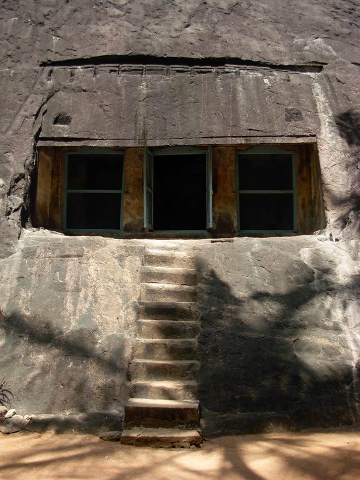
The east facing Sivagiri (சிவகிரி) Sri Mahadevar (ஸ்ரீ மகாதேவர்) rock cut cave temple is excavated on the eastern slope of Sivagiri hillock and therefore the cave lies in an east-west orientation. The prime deity Shivagirinathar appear in the form of Shivalingam and the Shivalingam image is sculpted out from the mother rock of the cave. The rock cut cave forms nucleus structure around which temple structures added in the subsequent period of time. The cave temple complex comprise a mukha-mandapam, cloister-mandapam (சுற்றுமாளிகை ) and another large mandapam (பெருமண்டபம்)..

Cloister Mandapam

The cloister mandapam is built around the three sides of single celled cave. The adhistana and the pillars of this mandapam are highly ornamented. On the east wing of the cloister mandapam is supported by composite pillars with amazing yali (யாளி) motif. Yali is a mythical creature seen in many  temples, often sculpted onto the pillars.  The pillars supporting the north and south wings of the cloister mandapam are sectioned as square, octagonal kattu, square, octagonal kattu and square. The facade of the cloister mandapam has a corridor (open court) and the access can be made through two entrances located on the east and north wings. The south entrance of the cloister mandapam leads to temple kitchen (மடப்பள்ளி) and large mandapam.

Nandi Mandapam

In the center of the mandapa there is a Nandi mandapam. The seated Nandi on a platform is facing Shivagirinathar, the presiding deity. Nandi mandapam is built on a plinth (adhishtana) with jagadi, khantam and peruvajana mouldings. The four pillars of the Nandi mandapam are sectioned as square, octagonal kattu, square, octagonal kattu and square. Above the pillars there are vettu potikas (corbel brackets) holding the prastara components such as uttira (beam), vajanam, valabhi and kapotha.

Mukha-mandapam

Mukha-mandapam is built to the west of Nandi-mandapam i.e., adjoining to the rock wall of the cave. It has a padabandha adhisthana with jagadi, octogonal kumudam, kantha with pada and flanked by kampa and pattika mouldings. Above the adhisthana is the vedika with vedikanda.  Mukkha-mandapam is supported by four square pilasters with capitals. The vettu potikas (corbel brackets) holding the prastara components such as uttira (beam), vajanam, valabhi and kapotha with kudus. The south and north walls are sectioned with square pilasters and shown as simple koshta-panjara. The entrance on the east wall is 0.61 cm in width and 1.36 m in height.

The sanctum can be approached either from flight of three steps with balustrade on the south or from similar flight of three steps with balustrade on the north. The two sets of flight of steps leads to the raised plinth with upana, thamarai, khanta and kapota mouldings.

Sanctum

The entrance from mukha-mandapam is supported by square pilasters on either side. The sanctum excavated from the rock. The sanctum measures 1.72 m in width in the north-south direction and 1.70 m in length in the east-west direction and 1.70 m in height. The sanctum entrance is 0.85 cm in width and 1.46 m in height. The sanctum houses Shivagirinathar (சிவகிரிநாதர்) in the form of Shivalingam.  Shivalingam sculpted out of the mother rock and the square 'avudai' measures 0.24 cm in height and 0.65 cm in length on all four sides. The cylindrical bana sits on the square avudai. The walls and roof of the sanctum are simple and plain.

How to get there?

One can easily get regular buses to Eraniel from other major cities of the country. All buses from Thingalnagar bus stand will pass through Eraniel. Many buses run from Nagercoil via Eraniel. For every 5 minutes you have buses to Nagercoil and for every 15 minutes you have buses to Thuckalay
Nearest railway station is Eraniel railway station. Nagerkoil railway station is the main junction
Nearest airport is Thiruvananthapuram International Airport. - 72 km away

Reference
  1. சிவகிரிக் குடைவரை தென்மாவட்டக் குடைவரைகள். மு.நளினி மற்றும் இரா.கலைக்கோவன். (தென்தமிழ்நாட்டுக் குடைவரைகள்: தொகுதி 3). டாக்டர் மா.இராசமாணிக்கனார் வரலாற்றாய்வு மையம், திருச்சிராப்பள்ளி. 2009. பக். 148 - 150. 
  2. சிவகிரி (sivakiri) - ஸ்ரீ மகாதேவர் (ஆழ்வார்கோவில்) திருக்கோவில்; தக்கலை - ஆழ்வார்கோவில்.

Sunday, October 16, 2016

Thirunanthikarai Cave Temple


Thirunandhikarai, (Tamil: திருநந்திக்கரை, Malayalam: തിരുനന്തികര )  also known as Thirunandhikara, rock cut cave is located in Thirunandhikarai village, Kalkulam (கல்குளம்) taluk, Kanyakumari (கன்னியாகுமரி மாவட்டம்) district, Tamil Nadu state, India PIN 629161. This village is located in the Kulasekaram (குலசேகரம்) - Pechipparai (பேச்சிப்பாறை) road and forms part of Thirparappu special village panchayat and Kulasekharam post office limit. The Latitude and Longitude coordinates of Kulasekaram are N 8° 22' 5.1445" (8.368096°) and E 77° 18' 3.0622" (77.300851°) respectively. The elevation / altitude of Kulasekaram is 280 meters (920 feet) above sea level.  

Kanyakumari, mostly preferred by travelers since it has many tourist attractions. There are around 25 tourist places in Kanyakumari district for the travelers to explore and they include Vivekananda Rock Memorial, Muttom Beach, Keeriparai Reserve Forest, and Ullakaarvi, all vie for attention. Other charmers include Government Museum, Thanumalayan Temple, and Kanyakumari Wildlife Sanctuary. Thirparappu Falls (திற்பரப்பு அருவி) is the famous falls in the Kothai River (கோதை  ஆறு). Kulasekaram has many rubber plantations. and has a respectable transport network Thirunandhikarai village and cave are located 3 km from Kulasekaram, 11 km from Pechiparai Dam (பேச்சிப்பாறை அணை), 5 km from Thriparappu Waterfalls, 38 km from Nagerkoil and 50 km from Kanyakumari. The nearest airport is at Thiruvananthapuram. The best season to visit places in Kanyakumari is between February - December. ISRO chairman Mr. Madhavan Nair was born and brought up in Thirunandhikarai.

There are two important Shiva temples in Thirunandhikarai:  Thirunanthikara Nanthishwaran Temple and Thirunandhikara Cave Temple. Nanthishwaran Temple is situated on the river banks of Nandhiaaru. Thirunandhikarai is the fourth shivalayam among the 12 saivite shrines in Kanyakumari district (1 Tirumalai, 2 Thikkurichi, 3 Thirparappu, 4 Thirunandhikkarai, 5 Ponmanai, 6 Pannippagam, 7 Kallkkulam, 8 Melancode, 9 Thiruvidaicode, 10 Thiruvithamkode, 11 Thiruppanticode and 12 Thirunattalam). There will be a marathon run by saivite devotees from shrine Thirumalai, the first shivalayam, to the twelfth, Thirunattalam on the day of Shivratri.  The traditional Shiva temple also houses shrines for Lord Shiva and Lord Vishnu.

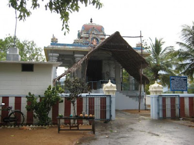
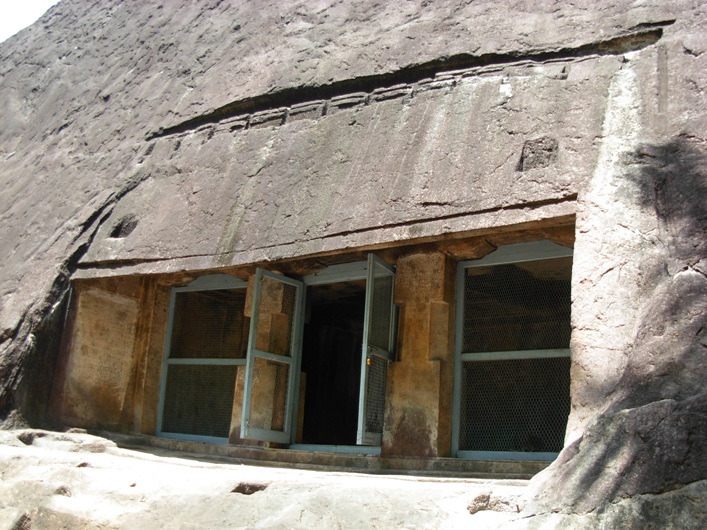
The south facing Thirunandhikkarai rock cut cave temple is excavated on the southern slope of the hillock and therefore the cave lies in an east-west orientation. The cave floor is formed 4 m above the ground level. A flight of ten steps (including the two steps provided later by Archaeological Survey of India (ASI), leads to the cave. Eight steps sculpted on the (mother) rock slope. The facade is 4.97 m in the north-south and 0.51 cm in the east-west directions. The evenly leveled rock ground is 5.68 m in the east-west and 64 cm in the south-north directions. The finely leveled rock floor is formed 4 cm above the rock ground and measures about 52 cm in the south-north and 5.40 m in the east-west directions. The upana is sculpted 5 cm above the rock floor and runs from east to west.  

The facade is 4.97 m in the north-south and 0.51 cm in the east-west directions. It consists of two massive pillars in the middle and two pilasters on the corners. The pillars and the pilasters are square-kattu-square in shape. The plain angular potikas (corbels) support the slender uttira (beam). and there is no vajana above uttira. The rough rock brow forms the kapota (not designed well). The canopy of the kapota is flat. and do not incline downwards. Above the brow there are two rectangular sockets. There are also two sockets on the rock floor. These four sockets suggest the chances of forming temporary shed (பந்தல்). One meter above the kapota, bhumidesa is indicated with grooves and carvings. 

The mother rock excavated well from top to down to match slopes of the hillock. The western wall is 1.97 m in height and 1.04 m in width  and the eastern wall is 1.89 m in height and 1.19 m in width. There are two 1.54 m tall (shallow) niches on both the walls and Vettezhuthu inscriptions.(வட்டெழுத்து கல்வெட்டுக்கள்) are inscribed. The Vattezhuthu inscription on the 82 cm wide eastern wall is damaged and the other inscription on the western wall is intact. The upper square, kattu and part of lower square of the western facade pillar bear another Vettezhuthu inscription.

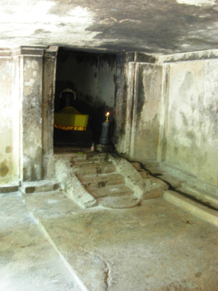
The facade leads to the rectangular mukha-mandapam which is 0.86 m in the north-south and 3.28  m in the east-west directions and 2.23 m in height. The inner-mandapam floor is raised to 0.6 cm in height. The mukha-mandapam floor is evenly sculpted. The plain eastern and western walls of mukha-mandapam show prastara components i.e., uttiram and vajanam between wall and the roof. The vajana is running through out the mandapam. The inner-mandapam on the rear is 5.40 m in east-west and 2.42 m in north-south directions and 2.18 m in height. Two square pilasters on either side of the cave walls of the inner-mandapam are supporting the uttira. The walls are plain.  The roof of the mandapa is well formed. 

The square sanctum is 2.16 m in all the four sides and 2.17 m height,. The walls and roof are plain. The Shiva Lingam is instituted in a socket pit which is 70 cm in east-west and 1 m in north-south directions. The square avudai is 82 cm in north-west and 78 cm in east-west directions and 0.53 cm in height. The external faces of avudai  is embellished with padhabandha adishtana with components such as jagadhi (ஜகதி), octogonal kumudam (குமுதம்), khantam with pada flanked by kampa and without patiikai.  The rudra bana is 44 cm in height. A small pit is shown towards north to receive the anointed water. A water chute is seen running up to the north wall and east wall of the sanctum and continued in the east wall of the mukha-mandapam. 

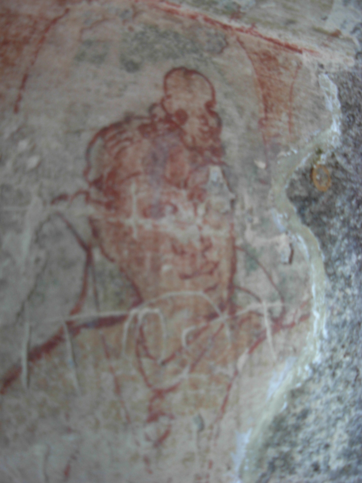
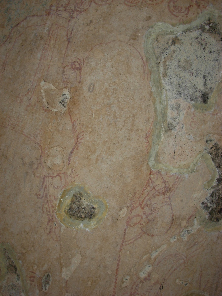
The northern wall of the inner-mandapam is washed with stucco coatings (sudhai) and painted with mural paintings. The mural paintings are considered as important since paintings belongs to earlier phase of Kerala mural art. The line paintings include the human figure with folded right hand on the chest and wears necklace with dollar. The right leg is folded and rested on the seat. The left leg could not be viewed.

The Ganapathy image is sculpted on the western wall of the mukha mandapam. The Lord wears Karandamakutam with head band, yagnopavitha, armlets and bracelets. The right rear-hand holds broken tusk, right fore-hand holds an unknown object, the rear left-hand holds sugar cane leaves and the fore-hand is damaged. The left tusk is visible and the right one could not be seen. The Vidyadharar is seen above right hand corner of Ganapathi. The flying figure holds a flower.

History:


Ay dynasty  ruled the land between Nagercoil and Thiruvalla and Vizhinjam, The Ay Kingdom located to the south of Chera kingdom "functioned for long as an effective buffer state between the declining Chera kingdom and an emerging Pandya Kingdom." Ay dynasty was later known as Venad (வேள்நாடு / வேணாடு) dynasty. This land was also the scene of many battles. In 788 A.D, Vikramaditya Varaguna (885–925), an illustrious Ay ruler ruled Venad. 

Jatilavarman Parantaka (Maranjadayan) the Pandya king waged a war over Ay kingdom and encircled Vizhinjam port. The Pandya conquered the Ays and made it a tributary state. Still the Ays refused to submit and fought against Pandyas for almost a century. Despite frequent defeats Cheras continued to exist as a fighting force. During ninth century Cheras rose again as a notable power. This region came under Cheras during the reign of Bhaskara Ravi Varman Tiruvadi (978 - 1036 A.D.). Rajaraja Chola I waged a war against the Venad ruler and captured the southern region and named it as Rajaraja Tennadu. Muttom is the fishing village in Kalkulam taluk. Rajaraj Chola I named it as Mummudi Chola Nallur. 

The department of archaeology was started under the initiative of Professor Sundaram Pillai and the then Maharajah of Travancore, Moolam Thirunal Rama Varma sanctioned the monthly grant of Rs. 50.00 for its functioning. The renowned  epigraphist T. A. Gopinatha Rao was employed as first Superintendent in the year 1908. T.A. Gopinatha Rao edited and published The Travancore Archaeological Series (T.A.S.) from 1910. Thus T.A.S. inaugurated the systematic survey and collection of inscriptions in the erstwhile Travancore state. The scholar also visited Thirunandhikarai and Chitharal caves in 1920-21 and copied and recorded the inscriptions from the caves. .According to T.A.Gopinatha Rao, the cave temple was built during the reign of the king Vikramaditya Varaguna. Chitharal was erected at Tirucharanam at the behest of a Jain priestess called Muttavala Naranakuttiyar, who also presented the temple a metallic lamp stand and a golden flower. Rao also believed that Thirunandhikkarai rock cut cave was excavated by Vikramaditya Varaguna, the Ay ruler in 9th century A.D in simple Pandya style. The rock cut caves were the founding caves of Jainism.  Thirunandhikarai cave also served as dwelling place to Jain ascetic Veeranandi, who came from Thirunarunkondai Melappalli and preached Jainism during 8th century. One more cave temple Kurathiarai  was also excavated in the ninth century when this region was under the influence of Jainism. Thirunandhikarai rock cut cave is under the maintenance of the Archaeological Survey of India (ASI).

Inscriptions:

This cave has four Vattezhuthu (வட்டெழுத்து) inscriptions (Travancore Archaeological Series (T. A. S.) vol. I., p. 413.)  inscribed one on each side of the entrance and others on each side of the pillars. One of which bears the name of the ruler and his regnal year. The inscription, dated in the 18th regnal year of Rajaraja Chola I (முதலாம் இராஜராஜ சோழன்) found on the western cave wall, registers the gift of Muttom (முட்டம்), the village  (name changed as Mummudi-chola-nallur மும்முடிச்சோழநல்லூர்) in Valluva-nadu (வள்ளுவநாடு) under Rajaraja-thennadu (இராஜராஜ தென்னாடு). The gift was made for the celebration of a festival for Mahadeva of Tirunandikarai (திருநந்திக்கரை மகாதேவர்) and also for ablution of the deity in the river, on the Satabhisha, star (சதய நட்சத்திரம்) day in the Tamil month Aippasi, (ஐப்பசி) (October - November) in the year 1003 A.D, being the birthday of the king. Records a provision made by the king for supply of one nazhi (நாழி) measure ghee every day for lighting the perpetual lamp in the name of Rajaraja Chola I in the temple.

Inscription Travancore Archaeological Series (T. A. S.) Vol. III, p. 206 records gift of nine buffalo(s) for the provision of burning a perpetual lamp with one uri measure ghee each day for Tirunandikarai Lord by Ainurruva Mutharaiyan alias Sithakutti Ambi of Veikottumalai under Nanjilnadu and the buffalo(s) were handed-over to Idayarmangalavan Pavithiran, an official serving under the village elders (sabha).  The inscription commences with these words 'the year of annihilation weaponry in Karaikanda Eswaram (‘கறைக்கண்ட ஈசுவரத்துக் கலமறுத்த யாண்டு’) refering the date of inscription. According to Gopinatha Rao, the temple 'Karaikanda Eswaram'  is the saivite temple located near Katikaipattinam in Eranial taluk. The inscription was inscribed in an year when the Chera war-ships were destroyed in Karaikanda Eswaram.    

Inscription Travancore Archaeological Series (T. A. S.) Vol. III, pp. 200-203 inscribed on a pillar, whose date assignable to eight century A.D., records the gift of 'Ur' (ஊர்-a village). For this purpose one Dhaliyazhavan (தளியாழ்வான்), along with the 'elders' of Tirunandikarai (திருநந்திக்கரை பெருமக்கள்) assembled in Kurunthambakkam (குருந்தம்பாக்கம்). The assembly converted the Ur's name into Sri Nandimangalam and gifted to one Nambi Ganapathi (நம்பி கணபதி) for purposes of mid-night offerings (நள்ளிரவுத் திருவமுது) to the Lord of the temple. The four boundaries (எல்லைகள்) are cited for the village under gift and include a river (name not known) (ஒரு பெயரற்ற ஆறு), Nandhi river (நந்தியாறு), Mudukonur (முதுகோனூர்) and Pakkamangalam (பாக்கமங்கலம்). Gopinatha Rao, who copied and recorded the inscription, has pointed out the present existence of  Mudukonur and Pakkamangalam near Nandhimangalam.

Inscription Travancore Archaeological Series (T. A. S.) Vol. III, pp. 203-206 comprising 40 lines was inscribed on another pillar. This inscription records the gift of land by Mangalacheri Narayanan Sivakaran to Tiruvallavazh Mahadevar of Tirunandikarai  (திருநந்திக்கரையில் உறையும் திருவல்லவாழ் மகாதேவர்). The inscription lists out the land pieces. Resolved the wages to be issued from the land produce accrued from the above land: four measures (கலம் Kalam) to Santhipuram, five measures (கலம் Kalam) to Uvachar (category of temple staff), five measures (கலம் Kalam) to Udayar (category of temple staff) and cleaning staff as well as for puja rituals, The perpetual lamps were lit using 60 measures (uri - உரி) of ghee from the remaining land produce. 

How to get there?

Road Transport : Thirunandhikarai and its nearest town Kulasekaram are well connected from Thirvananthapuram or Kovalam Beach or Kanyakumari. You can get busses from Nagercoil, Thuckalay, Marthandam, Kulasekaram. Kerala Tourism Development Corporation (KTDC) organizes local site seeing tours. 

Nearest Railway Station is Marthandam. Nagerkoil railway station is 15 km away. Kanyakumari railway station is connects with major cities in India.

Nearest Airport is Trivandrum International Airport.
Reference

  1. A topographical list of the inscriptions of the Madras presidency (collected till 1915) with notes and references by Rangacharya, V. (Vijayaraghava); Archaeological Survey of India 1919
  2. Kerala State Archaeology Department (Wikipedia)
  3. On the southern tip of India, a village steeped in the past. The Hindu November 17, 2011
  4. Thirunandikkara Cave Temple in Thirparappu in Kanyakumari. Yatra to Temples.com (http://www.yatrastotemples.com/thirunandikkara-cave-temple-in-thirparappu-in-kanyakumari/)
  5. Thirunanthikarai (Wikipedia)
  6. Thirunanthikarai Cave Temple. C.P.R. Environmental Education Centre, Chennai. (http://www.cpreecenvis.nic.in/Database/ThirunanthikaraiCaveTemple_2939.aspx)
  7. Thirunanthikarai Cave Temple. Tourmet.com (http://tourmet.com/thirunandhikarai-cave-temple/)
  8. Thirunanthikarai inscription. Kerala Culture.org (http://www.keralaculture.org/thirunanthikara-inscriptions/366)
  9. திருநந்திக்கரைக் குடைவரை இரா.கலைக்கோவன், மு.நளினி வரலாறு.காம் இதழ் 63 (செப்டம்பர் 15 - அக்டோபர் 15, 2009)

Saturday, April 25, 2015

Tirunelveli Region Travelogue (Pandyan Yatra 2015) Part 4.2: Rajagopalaswamy Kulasekara Perumal temple, Mannarkoil

Rajagopalaswamy Kulasekara Perumal temple, Mannarkoil
Our next stop was the Mannarkoil. Mannarkoil Rajagopalaswamy Kulasekara Perumal temple is located at a distance of about 1 km towards west side from Brahmadesam Kailasanathar Temple. From Ambasamudram The town and the temple is situated at a distance of about 5 km  from Ambasamudram off the Tenkasi  –  Kurtalam Highway.

Mannarkoil is an island  bounded by the Thamirabarani river on the south side, and the Ghatana river on the north side. The island looks like Srirangam near Tiruchirapalli. Rangam means island formed in between two river courses. Mannarkoil has always been in the pilgrimage itinerary in  Tirunelveli district by the vaishnavite population.

The historic Rajagopalaswamy Kulasekara Perumal temple (இராஜகோபாலஸ்வாமி குலசேகர பெருமாள் கோவில்) is situated on three sprawling acres of land in the village of Mannarkoil. The imposing perimeter walls enclose temple structures. The village and the temple are mentioned as Vedhanarayanpuram (sound of Vedas is always heard here) and Rajendra Chola Vinnagaram respectively in ancient records.  
 
Quick Facts
  • Name: Rajagopalaswamy Kulasekara Perumal temple, Mannarkoil
  • Historical Names: Vedhanarayanpuram (வேதநாராயணபுரம்), Vedapuri (வேதபுரி), Rajendra Vinnagaram (இராஜேந்திர விண்ணகரம்)
  • Presiding deity : Veda Narayana Perumal (வேதநாராயணப் பெருமாள்)
  • Processional deity : Rajagopalaswamy with Garuda
  • Consorts (Goddesses) : Vedavalli Thaayar (வேதவல்லித் தாயார்) and Bhuvanavalli Thaayar (புவனவல்லித் தாயார்).
  • Holy Tree: Jack tree  (Artocarpus heterophyllus)
  • Holy water: Tamirabarani river, Ghatana river, Bhrgu Theertha
  • Time to visit :  The temple is open from morning 7.00 clock till 12.00 noon and from 5.00 to 7.00 pm.
  • Location: Mannarkoil, bound by two rivers Thamirabarani  and  Ghatana. About 5 km West of Ambasamudram Town. Located in the Tirunelveli - Senkottah Road.
  • Contact: PS. Narasimha Gopalan Acharya @ 04634 252874

Unique Features

  • The village and the temple are located in an island surrounded by two perennial rivers - Tamirabarani and Ghatana.
  • In the 10th century A.D., after the Chola conquest of Pandyan country, the riverine of Tamirabarani - Ghadana nadi was established as a Chola colony.  Jatavarman alias Sundara Chola Pandya (1017-18 A.D), aka Chola Viceroy (feudatory of the Rajendra Chola I) formed new townships and converted the  forest lands for cultivation. This temple is the Chola temple built in the Pandya country. 
  • Ashtanga Vimana (Eight limbs or organs) architecture, one of the very ancient styles of temple construction, is radically distinctive vimana style of this temple. It is structural different from Sashtanga (six limbs or organs) vimana
  • Both the vimana and koshtam has Dakshinamoorthi (a form of Lord Shiva).
  • Vali worshiping Shivalingam
  • A dancing Ganesa sculpture
  • This temple has some miniatures of Ramayana.
  • The saint Kulasekara Azhvar spent his last 30 years in Mannarkoil and attained moksha here. Therefore Mannarkoil has become the Thiruvarasu Koil for Kulasekara Azhvar (திருவரசுக் கோவில்) (place where Azhvars join the feet of the Lord, is called 'Thiruvarasu' ) .  
  • As a token of respect, the temple authorities have aptly named this temple as Rajagopalaswamy Kulasekara Perumal temple.
  • Mannarkoil is the birth place of Vaadhi Kesari Azhagiya Manavala Jeer (வாதி கேசரி அழகிய மணவாள ஜீயர்) who wrote extensive explanation (vyakgnanam (வியாக்யானம்) or urai) to Thiruvai Mozhi (திருவாய்மொழி) - 1102 hymns, composed by Nammazhvar (நம்மாழ்வார்), forming part of Nalayira Divyaprabandham (நாலாயிர திவ்ய பிரபந்தம்) or 4000 Tamil Hymns (Pasurams பாசுரம்). The title of the explanation  is known as ‘Panniraayira Padi.’ (பன்னிரெண்டாயிரப் படி).  
  • Shri.Narasimha Gopalan Acharya, who belongs to the Periya Nambi ancestry, has taken single handed effort to renovate the temple from dilapidated state. He only received very minimal support from HR & CE. He is very keen in cultivating Shenbagam flower garden. His monthly salary seems to be just Rs. 245 only.

The temple, built in the 11th century A.D., during the rule of the Chola monarch Rajendra Chola I (முதலாம் இராசேந்திர சோழன்) (1012-44 A.D.), has a very unique architectural design. Unlike the majority of the temples which have only one main sanctum enshrining the presiding deity, Mannarkoil has  three vertically aligned sanctums, all facing east, one above the other, each housing one image of Lord Vishnu. The canonical texts call this style as ashtanga vimana.

Ashtanga Vimana

Ashtanga means 'having eight limbs or organs.' Usually, as a rule, vimanas are built on the basic six limbs or components: 1. adishtanam (plinth), 2. padam (pillars and the wall), 3. prastara (roof), 4. khandam (neck) 5. shikara (spire), and 6. stupi or kalasa (finial). In ashtanga vimana the main sanctum enshrines the presiding deity of the the temple. In between prastara  and khandam parts of the vimana the second shrine will be built above the main sanctum on the first stage (floor). The third sanctum will be built in between khandam and shikara  above the second sanctum. Thus ashtanga vimana will have 1. adishtanam (plinth), 2. padam (pillars and the wall), 3. prastara (roof), 4. second sanctum 5. khandam (neck)  6. third sanctum, 7. shikara (spire), and 8. stupi or kalasa (finial). Lord Vishnu, in ashtanga vimanas, is generally seen in either of the 3 forms, Ninraan (நின்றான் - Perumal in standing posture), Irundhaan (இருந்தான் - Perumal in sitting posture) or Kidandhaan (கிடந்தான் - Perumal in reclining posture like Ranganathar)

Ashtanga style of vimana, with three sanctums one above the other, was first built in the Vaikunda Perumal temple (வைகுந்தப் பெருமாள் கோவில்)  aka. Parameswara Vinnagaram (பரமேஸ்வர விண்ணகரம்), Kanchipuram in 690  A.D., during the time of Pallava ruler, Nandivarman II aka Pallavamallan (இரண்டாம் நந்திவர்மன் என்ற பல்லவமல்லன்) (731 - 796 A.D.). Sri Sundara Varadaraja Perumal temple, Uttaramerur (சுந்தர வரதராஜப் பெருமாள் கோவில், உத்தரமேரூர்) was built in 750 A.D. during Pallava rule on the model of Vaikunda Perumal temple, Kanchipuram. But, as a unique feature, Uttaramerur temple ashtanga vimana has three more sanctums around the main sanctum in the three cardinal directions in the ground stage and first stage. There are nine Mula Virats (main deities) under the same vimana. Lord Sundara Varadaraja Perumal in the main sanctum and the deities present in the ground stage include Kalyanavaradhan (south), Achutavaradhan (west) and Anurudhravaradhan (north). Lord Vaikundavaran is enshrined the sanctum above the main sanctum in the first stage and the deities present in the first stage include Bhagvath-Gita Krishnan with Arjun (south), Yoga Narasimmha (Lord in half human half lion form) (south) and Bhuvaragan (Lord in boar form) with Lakshmi (north). There is also Sri Dhakshinamurthi on the vimana facing south which is unusual in Vaishnavite temples. Lord Ananthapadmanaban is enshrined in the second stage sanctum. 

The other temples with ashtanga vimana include Sowmya Narayana Perumal (சௌமிய நாராயணப் பெருமாள்) temple in Tirukoshtiyur, Sivagangai district; Sri Koodalazhagar Perumal (கூடலழகப் பெருமாள்) temple, Madurai; Raja Mannar temple, Srivilliputtur; Sri Aadhi Narayana Perumal temple, Cheranmadevi; and Ashtalakshmi temple, Besant Nagar, Chennai.

The two tier (dvi-tala)  ashtanga vimana is having the Chola style of architectural features. The base vimana structure (from adishtana to prastara) is made out of hard granite stones. The super structure is made of brick and lime mortar mixed with palm sugar. The plinth (prathivari bandha adishtanam) of the sanctum includes jagathi, round (vritta) kumudham, prati or pattika. In between the wall and the basement the vedika component with a frieze of Vyala vari (row of Leogrif motif) elements is shown.   The entire pada portion of the vimana is divided into three segments called the pathis or bhadras. The projected corner pathis are called as karna pathis or karna bhadras. In between karna bhadras is projected rectangular sala pathis or sala bhadra. Between karna bhadras and sala bhadras comes koshta panjaras flanked by spilit pilasters. Usually the koshta panjaras will have shrines, but here it is empty. In between the kapota and first tala is shown another vedika component with a frieze of buta-vari. Each tier of the vimana, above the kapota with kudu arches, is formed with regular arrangement of karna-kuta (square shrine placed on corners), panjarasala (oblong shrine placed on sides), panjara, sala and karna-kuta.  

In between prastara  and oblong shaped khandam (neck) parts of the vimana the second sanctum is built above the main sanctum on the first stage (floor). The third sanctum is built in between khandam (neck) and sala shikara (decorated with kirtimukha at both the faces) above the second sanctum. There are five brass (finials) stupis project from the sala shikara 
 
Lord Veda Narayana Perumal

Lord Veda Narayana Perumal (வேத நாராயணப் பெருமாள்), presiding deity of the historic Mannarkoil temple is enshrined in the main sanctum which faces east. The imposing image is seen in standing posture holding the conch (sankha) and discus (chakra) in his upper hands.  The lower right hand in abhaya hasta mudra and lower left hand resting on his hip and flanked by Ubhaya Nachiyar (Sri Devi and Bhu Devi).  Lord is composed of stucco (sudha) of herbals (வர்ண கபால திவ்ய திருமேனி). The two sages Markandeya (மார்கண்டேயா) and Bhirgu (பிருகு) also appear with folded hands.


Procession deity Mannarkoil
The Rajagopalaswamy, the bronze processional deity appear along with goddess Andal and Garuda in the main sanctum.  Also there are bronze icons of Sri Rama, Sita,  Lakshmana and Hanuman found in this sanctum. A small and cute Garuda idol is located before the main sanctum. Also there are flagstaff and balipeeta before the sanctum.

Sitting Perumal @ First stage
A narrow flight of stairs, leading to the first stage has been constructed on the south prakaram of the main sanctum on the ground stage. The Lord appears in sitting posture in the first stage of the ashtanga vimana. A small hole or gap (Pillai Thondu) is found before the sitting perumal.  In Tamil 'Thondu' means way. The women beseeching child boon will pass through this 'Pillai Thondu' as part of their votive prayer to the Lord. Another flight of stairs with narrow width leads to the second stage of vimana. At the second stage still above the first stage the Lord appears reclining on Adisesha.

Mannarkoil Ashtanga vimana
Reclining Perumal @ Second stage
The reclining Perumal has two two different prakaras 1. broader elephant pass (yanai thondu or yanai mudukku) and 2. narrower cat pass (poonai thondu or poonai mudukku). There is a wooden mandapa before the reclining Perumal. The roof of this mandapa has the carved images of zodiac signs. The shrines in the first and second are built with lime mortar and palm sugar. Thus Lord Veda Narayana Perumal graces his devotees in three postures – standing, sitting and reclining.

Ashtangavimana Second stage

The east facing temple has single entrance and two prakarams, an ardhamandaba, mahamnadaba, connecting mandaba surrounded by a cloister mandapa (திருச்சுற்று மாளிகை) around the main sanctum. There are separate shrines for goddesses Vedavalli and  Bhuvanavalli in the circumambulatory path. The circumambulatory path also has separate shrines for Lord Narasimha and Viswakshena. The stucco images of both the goddesses appear seated. Vaishnava saint Kulasekara Azhvar (stucco image) is enshrined in a separate shrine in the northern prakara with separate flagstaff and balipeeta before the sanctum. The sanctums of two Vaishnava acharyas Ramanuja and Manavalamamunigal are located in two separate mandapas. This elaborately decorated structure exhibits typical of the Nayaka architectural style with exquisitely carved composite pillars. There are life size statues of Lord Rama and other gods, kings with folded hands forming part of the monolithic pillars.

Legend

The Mannarkoil region was once dense forest with jack trees. After paying visit to many holy shrines, sages Brigu and Markandeya reached Mannarkoil for penance. They prayed the Lord to appear before them in his three postures (standing, sitting and reclining postures) and Lord Veda Narayana Perumal appeared before them in the same way. The sages expressed their wishes to the Lord and prayed the Lord to appear before one and all who manage to visit this shrine and bless them for happiness and prosperity. Lord gave his consent and decided to stay at Mannarkoil and continue to bless all devotees.

History

The Tamirabarani - Ghadananadi river region was established as a Chola colony after the Chola conquest of Pandyan country in the 10th century A.D. Jatavarman alias Sundara Chola Pandya (1017-18 A.D), the Chola-Pandya king aka Chola Viceroy (feudatory of the Rajendra Chola I) formed new townships and converted the  forest lands for cultivation.  The inscriptions at the Veda Narayana Perumal  temple at Mannarkoil village informs us that the big Brahmadeyam village of 'Rajaraja Chaturvedi Mangalam' in Mullinadu in the 'Mudikonda Chola Valanadu' of Raja Raja Pandinadu was made over to Brahmins as gifts. The hamlets of 'Ilangokudi' (today's Ambasamudram), Kallidaikurichi, Aththala Nallur, Vazuthiyoor, Alwarkurichi and Pappankurichi were parts of this big Brahmadayam village (now Brahmadesam).

Rajagopalaswami Kulasekara Azhwar temple, a Chola temple in the land of Pandyas, was built by Chera king  Rajasimha (1028- 1043 A.D.) with the permission of Rajendera Chola I. The Chera has also donated land to the temple at a later date. The village is also known as Rajendra Chola Vinnagaram, named after the Chola monarch Rajendra Chola I, who has made significant contribution to the temple. Jatavarma Chola Pandya has also made considerable contributions. Finally there are contributions from Nayaka rulers.

Kulasekara Azhvar
Kulasekara Azhvar Thiruvarasu temple
Kulasekara Azhvar, one of the twelve azhvars and believed to be a king from Kerala region (some other consider him as ruler of Kolli hills or Madurai Koodal or Kongu regions). During his early years, he conquered Chola and Pandya kings and was a force to reckon with. Lord Vishnu blessed  him with spiritual insight and led him to renounce power and sing hymns in praise of the Lord and the shrines of the Lord. After having darshan of Lord in several shrines, the Azhvar reached Mannarkoil and he had an emotional attachment with Lord Rajagopalan. It is believed that Kulasekara Azhvar brought away the bronze idol of Lord Rajagopalan from Mannargudi forcibly since he showed intense emotion with Rajagopalan. His aradhana idols Sri Rama, Lakshmana and Sita are being worshiped here as ablution deity (abhisheka moorthy).  The saint spent his last 30 years in Mannarkoil and attained moksha here. Therefore Mannarkoil has become the Thiruvarasu Koil (place where Azhvars join the feet of the Lord, is called 'Thiruvarasu' ) for Kulasekara Azhvar.  As a token of respect, the temple authorities have aptly named this temple as Rajagopalaswamy Kulasekara Perumal temple. His shrine is unusually provided with flag post and bali peetam. Surprisingly Pandya country is known for many 'Thiruvarasus' of Azhvars: Nammazhvar Thiruvarasu at Azhvar Thirunagari (Tamarind Tree), Periazhvar Thiruvarasu at Alagarkoil;  Tirumangaiazhvar Thiruvarasu at Tirukurungudi (Malaimel Nambi).

Inscription

There are numerous inscriptions of Jatavarman Sundara-Chola Pandya found on the outer (southern, western and northern) walls of the main vimana base dating back to the Chola period:- 

According to Ep. Ind., Vol. XI, pp. 294 the Chera  king Rajasimha was a contemporary of the first viceroy Jatavarma Sundara Chola Pandya. Inscriptions mention about the existence of Temple Mahasabha empowered to register all the land grants from monarchs - Chola and Pandya rulers. The land grants were realized when these rulers camped in near by places like Velaikurichi and Kallidaikurichi. In this way there are references about the gifting of the village of Velancholai  (வேலன்சோலை or வேலஞ்சோலை) to the temple.

The 4th year reign - inscription records some decisions taken in the meeting of the assembly held in a hall of the ambalam about the land and houses granted to the gardeners, drummers, potters, garland makers, torch bearers and temple dance girls (devaradiyar). Location: on the south wall of the temple, (ARE No 107 of 1905 - SII Vol XIV 132). 

The 6th year reign - inscription records the order about the gift of taxes on the land (endowed as a devadana to the temple) in a village called Manabharana Chaturvedimangalam. Location: on the north wall of the temple (ARE No 108 of 1905 - SII Vol XIV 133)

On the 139th day in the 13th year reign - inscription records the details of land sale by the sabha of Rajaraja Chaturvedimangalam to the temple. The 14 and odd veli of land in extent was regrouped into a new hamlet called Sola Pandyanallur and converted  into a tax-free devadana. (Ref: ARE No. 109 and 144 of 1905) Location: on the west wall of the temple (ARE No. 110 of 1905 - SII Vol XIV 145).
 
In the 14th year reign - inscription registers the sale of the village Manabharana Chaturvedimangalam, a brahmadeya in Mulli Nadu, which was the property of two brahmanas of Nigarilisola Chaturvedimangalam named Govindan Madhava bhattan and Govindan Tiruvikraman, to the temple. Also records that the brahmanas had originally obtained the village as the gurus of the ruling dynasty. Location:  on the north wall of the temple (ARE No. 106 of 1905 - SII Vol XIV 148). 
 
In the 18th year reign - inscription registers the sale by the sabha of Rajaraja Chaturvedimangalam to the temple. Location: on the north wall of the temple (ARE No. 109 of 1905 - SII Vol XIV 144).

Another inscription records gift of land to 12 brahmins who had settled down in the village from towns such as Thirukurungudi, Tirukurugur (Azhwar Thirunagari) and Thirumaliruncholai (Azhagar Koil), in recognition of their recitation of the 'Thiruvaimozhi' in the Thiruvaimozhi Mandapam (even now called in  the same).

One more inscription records to the Mahasabha accepting the legacy of land from two widows only after their male relatives had agreed to the land being gifted to the temple. In cases where the signatories to a contract were illiterate, others had signed on their behalf.

Two other inscriptions record routine matters like 1. the appointment of Sankaranayanar as the dharmakarta in Kollam year 764; and 2. the gift of land to some common people like the temple watchman.

Mural Paintings
 
Effacement of the Murals in the name of Conservation
Mural Paintings defacement
Mural painting of Lord Narasimha effaced and defaced
Mural Painting of Narasimha
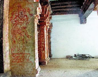
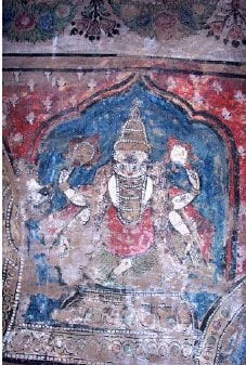
The author in his article Paramount Public cry for preservation of India’s Cultural Heritage   refer to the defacement of mural paintings in this temple. His photographs (shown here - taken three years ago) show some surviving mural paintings juxtaposed with the white washed wall on the right where a ceiling-high painting of Lord Narasimha once existed.

Festival 

A number of festivals are celebrated in this temple. The temple is agog with activity during the Chithirai Brahmotsavam is conducted in the Tamil month Chithirai (April - May). Procession of Azhvar Pushpa Pallakku (flower palanquin) and Teppotsavam (float festival) in the Tamil month Thai (Jan - Feb).

How to Get there?

Mannarkoil village is located about 5 km from Ambasamudram  on the western side of Tenkasi - Kutralam Highway. Ambasamudram is is 35 km Tirunelveli. Plenty of buses are plying from Tirunelveli as well as from Tenkasi. 


Reference

  1. Besant Nagar (Wikipedia) http://en.wikipedia.org/wiki/Besant_Nagar
  2. In the name of a devotee. The Hindu.
  3. Paramount Public cry for preservation of India’s Cultrual Heritage  http://www.hindujagruti.org/news/10650.html 
  4. Ramayanam before Kamban 76 - Mannar Koil http://ponniyinselvan.in/forum/discussion/44839/ramayanam-before-kamban-76-mannar-koil/p1
  5. South Indian Inscriptions Vol XIV Pandya Inscriptions: Chola-Pandya Viceroys
  6. The connection between Kulasekara Azhwar and Mannargudi Rajagopalan http://vishishtadhvaitham.blogspot.in/2014/10/the-connection-between-kulasekara.html
Related Posts Plugin for WordPress, Blogger...